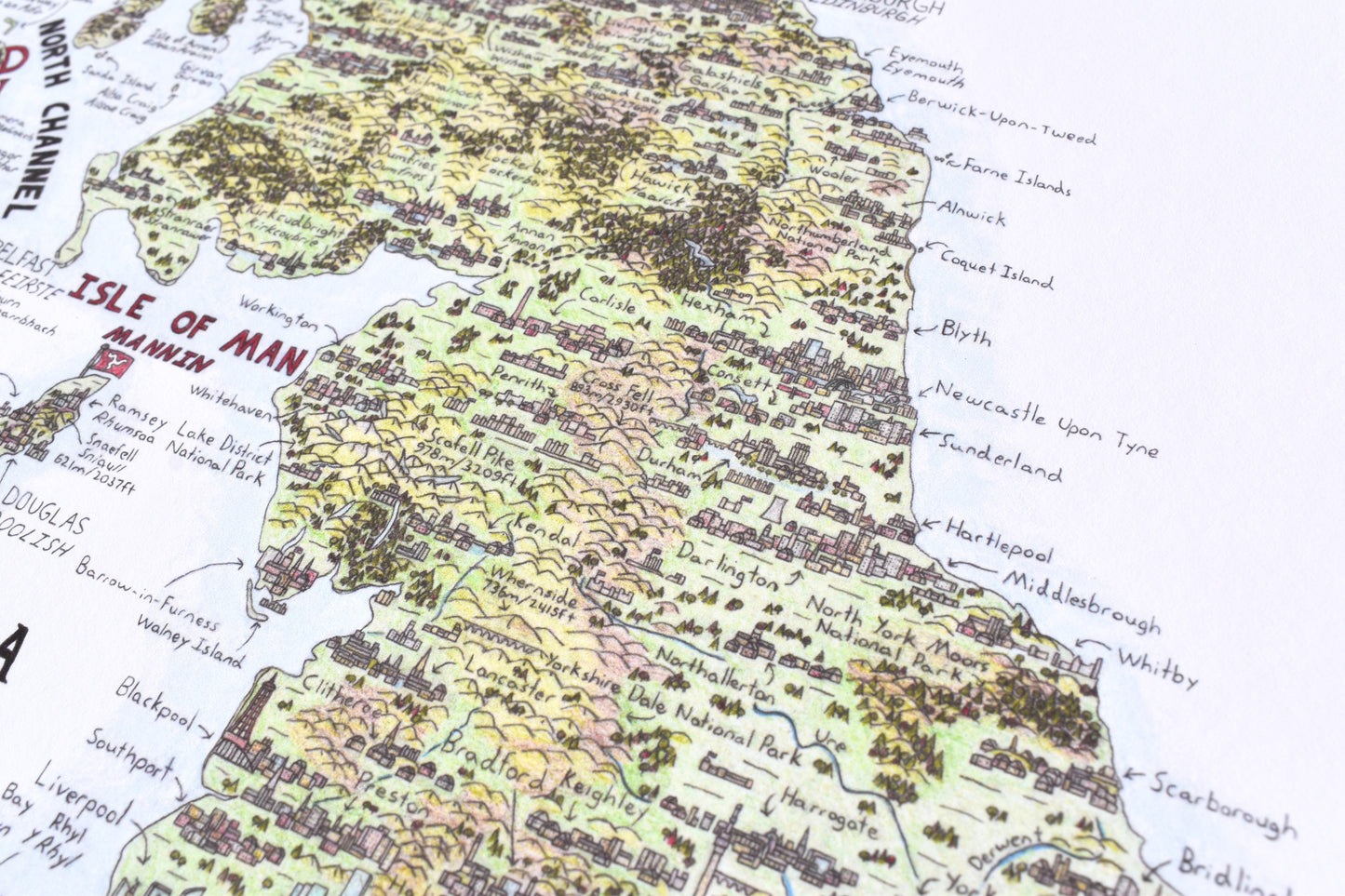
Hand drawn map of the United Kingdom, Ireland, and the Crown Dependencies, completed over the course of 1.5 years. Very high level of detail with over 280 hand drawn cities as well as many castles and other buildings scattered all over the map. Full terrain drawn including mountains, forests, rivers and all 21 national parks. Featuring 12 different language translations: English, Guernésiais, Jèrriais, French, Auregnais, Serquiais, Cornish, Manx, Irish Gaelic, Welsh, Scots, and Scottish Gaelic, based on languages from regions on the map.
-Size: 24 x 36" (610 x 914mm).
-Printed on Hot Press Smoothed Bright White 300gsm cotton fine art matte paper for maximum detail. Archival for 200 years.